Name a location. Get its real shape.
No drawing a box. No uploading files. No approximations. Type any place on Earth and download a print-ready model of its true terrain.
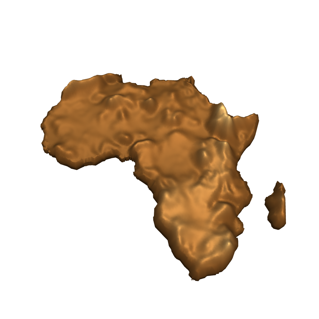
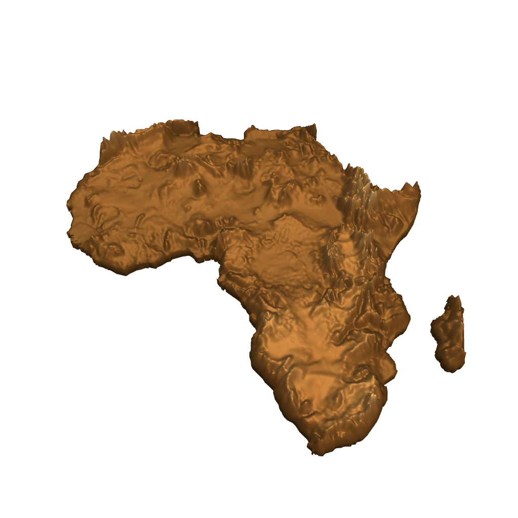
Type a place name and you get its true administrative shape, the real coastline, the real border, filled with real elevation data. It sounds simple. Nothing else does it.
Map tools make you draw a box and hope it's close. AI tools generate a plausible guess that isn't actually the place. The professional GIS route works, if you want to wrangle shapefiles and elevation data yourself.
Alticarta is the one where you name the place and get the real thing. No rectangles. No approximations. No GIS.
The tool I needed
I started making to clear my head, and it became the thing that does. Somewhere in there it pointed me at maps.
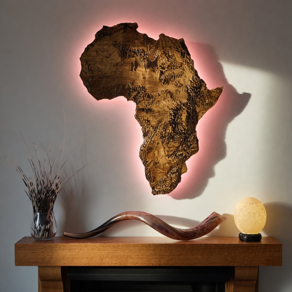
I've been lucky enough to stand in places most people only see in films. Mountains, coastlines, deserts, the kind of country that stays with you. I'm a husband and a dad now, and I don't get to those places the way I used to. But a relief map brings them back. Not a flat picture of a place. The place itself, shrunk down to something you can hold. That's why Alticarta builds real topography from real elevation data, and not a trace or an image.
I spent years overpaying for STL files that never matched what I was after, paying first and finding out after. Eventually I got tired enough to build the tool I wished existed. And because I know what it's like to buy blind, you see exactly what you're getting, free, before you pay a cent.
- Everything in Per Download
- 10 downloads each month
- Resets each billing cycle
- Cancel anytime
- Everything in Per Download
- 25 downloads each month
- Resets each billing cycle
- Cancel anytime
- Early access to new features
- Everything in Per Download
- 75 downloads each month
- Resets each billing cycle
- Priority processing
- Cancel anytime
- Any region, mountain, or feature
- Smoothed-detail STL output
- No signup, no credit card
- Everything in Free
- Sharp peaks · Full surface detail
- Custom dimensions · All formats
- Raised border frame · No watermark